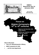
Newsletter No 24
8.44 MiB
Titles of articles
International Conferences and Study Sessions
- 2005 Study Session: Belgian Cartography – 16th to 19th centuries, Speakers: Jan De Graeve, Joost Depuydt, Wouter Bracke, Luc Janssens, Bernard Jouret, Lisette Danckaert
Excursions
- 2005 Bitburg, Visit to Dr. Tomasz Niewodniczański in Bitburg, Germany
History of Cartography
- Seven letters to Abraham Ortelius acquired by the Plantin-Moretus Museum in 2004, Dirk Imhof
- Those brilliant but forgotten scientists of the 19th century (Part I), Bernard Jouret
Looks at books
- Atlas Maior of 1665, abridged facsimile of Joan Blaeu’s atlas by Taschen-Verlag, Peter van der Krogt
- Cartes de l’Île de Ré ; Alain Gaudillat
- Geschiedenis van Brabant van het hertogdom tot heden. Histoire du Brabant, du duché à nos jours, by Prof. R. Van Uytven and others
Map of the Season
- Maps by Fricx, Wouter Bracke
Pictures at an Exhibition
- Catoen & Compagnie (Cotton and Company) - Textile Trade and Cartography
- From the Azores to New Zealand - The 14 Belgian colonies
- In goede banen? - The provincial road atlases in Belgium