The Brussels Map Circle International Conference
Early maps of Indonesia
Brussels, Belgium
We follow a chronological line, starting with the Portuguese explorers and their maps, with attention paid to some contemporary, non-Portuguese mapmakers. We then continue with the other European explorers and mapmakers who mapped the region. Given the importance of the Dutch both for the history of Indonesia and for that of mapmaking, two Dutch speakers will highlight this. They will start by sketching the general picture of the presence of Dutch mapmakers in Batavia, where the VOC (Vereenigde Oostindische Compagnie – the Dutch United East India Company) had its headquarters and then continue on a more pointed and controversial issue: that of the (supposed?) secrecy of the VOC maps.
Programme
- Short overview of Indonesian history (1580-1950) - Putting early cartography into perspective.
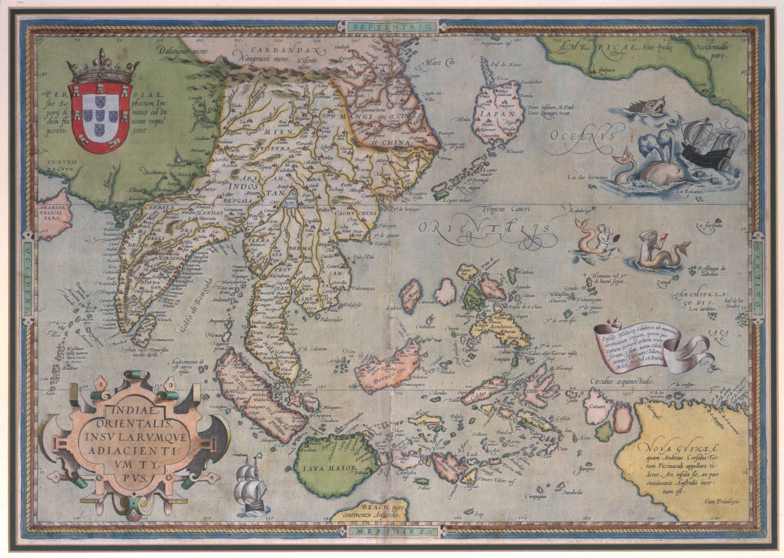
By Hans D. Kok, retired KLM B-747 pilot and manager, Chairman IMCOS (London, UK) - It is not our intention to go farther on from here. The Portuguese voyages to the Spice Islands and the first European maps and sketches of Southeast Asia, 1512-ca 1550.
Our purpose is to present an overview of the Portuguese cartography of the Indonesian archipelago between the maps and sketches drawn by Francisco Rodrigues in the aftermath of the first Portuguese expedition to the Moluccas in 1511-12 and the 1554 world map by Lopo Homem. We will cross some references regarding coeval Spanish and French cartography, identifying the political and historical contexts of elaboration of each of these series of maps.
By Francisco Roque de Oliveira, Centre for Geographical Studies, IGOT-Universidade de Lisboa, Portugal. - How the search for the Spice Islands unrolled the map of the World.
Providing a general overview of his book, The cartography of the East Indian Islands - Insulae Indiae Orientalis, the author will describe the importance of the search for the Spice Islands, the Holy Grail of the majority of the great Renaissance voyages of exploration, in opening up the world and promoting the mapping of the same.
By David Parry, Soil Scientist, Environmental Development Consultant and Curator, Indonesia. - Local exploration highlights in the days of the Dutch United East India Company (VOC).
An overview from the exploration of the archipelago from Batavia, including the travels to Australia/New Zealand (Tasman) and Japan (Maarten Gerritsz. Vries), with some explanation about the map production of the Dutch East India Company (the VOC).
By Hans D. Kok, retired KLM B-747 pilot and manager, chairman IMCOS (London, UK). - Confidential or commercial? The conflicting interests within the Blaeu and Van Keulen mapmaker families.
For two periods, the office of VOC mapmaker was in the hands of two well-known map publishing families: the Blaeus (1633-1705) and the Van Keulens (1743-1799). Although the VOC mapmakers had to swear secrecy, it is open to question to what extent VOC cartography was considered confidential. How did the Blaeu and Van Keulen families reconcile the role of official VOC mapmakers with their activities as commercial publishers? Was there a conflict of interest between their commercial activities and their commitment to the VOC?
By Martijn Storms, Curator of maps and atlases, Leiden University Library, The Netherlands. - Some Dutch and British military manuscript surveys and maps of Java and Sumatra, chiefly 1810 to 1814, in Netherlands and UK collections.
During the British interregnum of the former VOC possessions – specifically Java and Sumatra – to ensure non-capture by the French during the latter period of the Napoleonic Wars, an armada from British India was despatched to Java. Manuscript copies of late 18th-century Dutch maps were made. With Dutch help, too, the British military forces re-surveyed, reviewed or completed mapping in several areas and features – the High Military Road from Batavia [Jakarta], for example, with an accompanying itinerary. This work was carried out for both the British military governor (Lord Minto) and the civilian lieutenant-governor (T.S. Raffles); the responsible Deputy Quarter-Master General was W. Thorn.
By Francis Herbert, retired Curator of Maps, Royal Geographical Society-IBG, London, UK; founder member of BIMCC / Brussels Map Circle; active (publishing) member of the International Cartographic Association’s History of Cartography Commission.
Handout of the conference: available on-line here.
REGISTRATION: please register here.