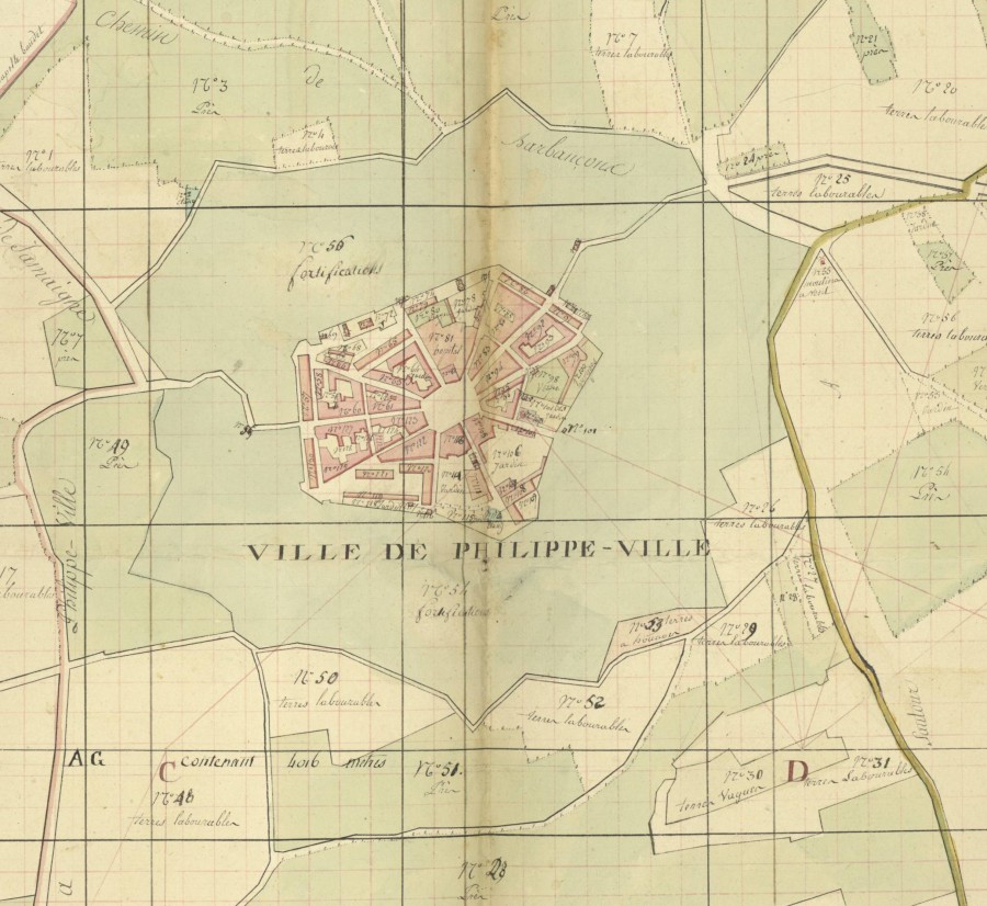
The cadastral map of Philippeville
–on line, France
A town in the Ardennes with a military vocation - The cadastral map of Philippeville.
Faced with the capture of Mariembourg (now in Belgium, to the west of Givet and to the north of Rocroi) at the end of June 1554 by the army of Henry II, then King of France, the Emperor Charles V, who was his main rival at the time, decided to retaliate by erecting two fortresses in the Entre-Sambre-et-Meuse region, located further east: Charlemont and Philippeville.
On 25 September 1555, Prince William of Orange set his sights on a site in the Echerennes area, more specifically the town of Corbigny, not far from Mariembourg and the Givet plateau. At that time, the streets and ramparts that would become Philippeville were marked out.
On 1 October 1555, work began on the fortress itself (the date is inscribed on the pediment of the Philippeville church door). The original plan was an irregular pentagon made up of five bastions with orillons, three straight curtain walls, two broken curtain walls and firing platforms. Armament and supplies were completed by December.
On 29 December 1555, the Prince of Orange wrote to Philippe II, King of Spain: "I have named this fort Philippeville, to be built at the advent of his reign".
The first garrisons of soldiers occupied the site in January 1556.
During the sixteenth century, many Italian engineers were employed by the Spanish and Dutch to build fortresses and new cities. It was a Fleming, Sébastien Van Noyen, who designed the layout of Philippeville.
Later, the town of Mariembourg reverted to Spain under the Treaty of Cateau-Cambrésis on 3 August 1559, rendering the fortress useless. Philippeville continued to exist as a military post, however, and was not raised to the rank of town until 1620.
Under the Pyrénées Treaty of 1659, Philippeville became French territory. This territory was then an enclave within the Spanish Netherlands, which was attached to the rest of the Kingdom of France via the commune of Givet. During this period, the engineer Vauban made a number of changes to the fortifications, accentuating their star shape. The attached map shows these modifications and those to the private dwellings, which were redeveloped at the end of the eighteenth century.
Finally, in 1815, the fortress was returned to the Netherlands, in what would become Belgium fifteen years later. The fortress convention of 14 December 1831 and the creation of a new defence system for the new country led to the demolition of the fortifications, which began in 1853 and was completed in 1856.