Home → News → The map of La Terre et Prévôté de Neufchâteau avec ses dépendances in 1609 is now hanging in the new building of the State Archives of Belgium in Arlon
The map of La Terre et Prévôté de Neufchâteau avec ses dépendances in 1609 is now hanging in the new building of the State Archives of Belgium in Arlon
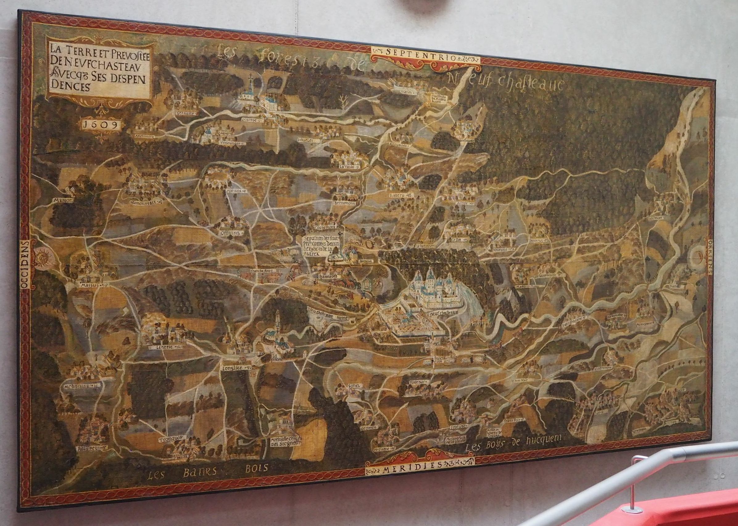
The State Archives of Belgium in Arlon recently took possession of their new building. On this occasion the map of La Terre et Prévôté de Neufchâteau avec ses dépendances in 1609 took place in the stairwell. This layout offers the curious a unique point of view to appreciate all the features of this map. It is an oil painting on canvas of 3.7 × 2.1 metres raised in 1609 at the initiative of Charles d'Arenberg (1550-1616).
Opening hours of the Archives: Tuesday to Friday and every first Saturday of the month except July and August from 9.00 to 16.30. The map is visible for free. Access to the archives is also free.
Map of La Terre et Prévôté de Neufchâteau avec ses dépendances en 1609
Read more on the Carte d'Arenberg de la Prévôté de Neufchâteau en 1609.
Other references: Hannick, Pierre, and Jean-Marie Duvosquel. La carte d'Arenberg de la terre et prévôté de Neufchâteau en 1609 (avec le ban de Mellier et la seigneurie de Bertrix), édition commentée en enrichie d'un dossier cartographique (18e-20e siècle). Bruxelles. Crédit communal, 1996.